Author Archives: rick.romine

MT Day 1 – Glade House

We wake before the sun, with plenty of time to consume French press coffee, passion fruit yogart, and Santitarium granola. We pack our last few items, and then check the leftover luggage with the Lakefront Apartment front desk. God willing, we will return to retrieve it in about five days time.

The first leg of the hike is carrying our backpacks and small Mitre bags across town. The Mitre bags are small clothes bags for things that will be waiting for us at the end of our hike, but before our five hour bus ride back to Queenstown. Apparently the bus driver has smelled Milford track hikers before, and prefers them in clean clothes. Terri is complaining about the weight of the pack on her shoulder before we are even half way to the bus.

As we queue up for the bus, we make one last Skype to Kevin, our youngest. He tells us more about the job offer he received from a company in Texas. It is possible his last few weeks at home will be while we are here in New Zealand. The three cats, now depending on the boy for food, water, and affection, are suddenly at risk – not to mention the sanity of his parents who are proud, yet dreadful of returning to an empty nest.

We drive along glacier carved lakes, passing massive fields of expected white sheep, and puzzling crowds of unexpected red deer. The venison market in Europe and Asia is apparently enough to drive local farmers to raise herds of Bambis.

We stop for a quick buffet of salads, wraps and a mountain range of connected triangular sandwich wedges. The sandwiches are some form of IQ test, which we royally fail. It seems theoretically possible to pluck out a combination of eggs, tomatoes, lettuce and bread that both begins and ends with bread. Even with 46 trip participants trying, however, that hypothesis is never proven.

After a few more miles in the bus, we reach the boat dock, where we pick up two more guides, and Lewis. Lewis is a chef at Mitre Peak Lodge, our last stop on the trek. An employee benefit allows workers to join a trip on their time off. This week, instead of scrambling eggs and cooking lamb shanks at Mitre Peak, Lewis will be walking with us. 

Although not raining, the torential wind-spray leaves standing on the upper deck of the boat a bit too much like standing on the boot of your car in a carwash. 

Getting off the boat we are each handed a random backpack from the pile, to sort out more quickly on shore. We feel like Goldilocks as we realize some packs are clearly lighter than ours, while others are much heavier. When we do finally find our own, they feel juuuust right.

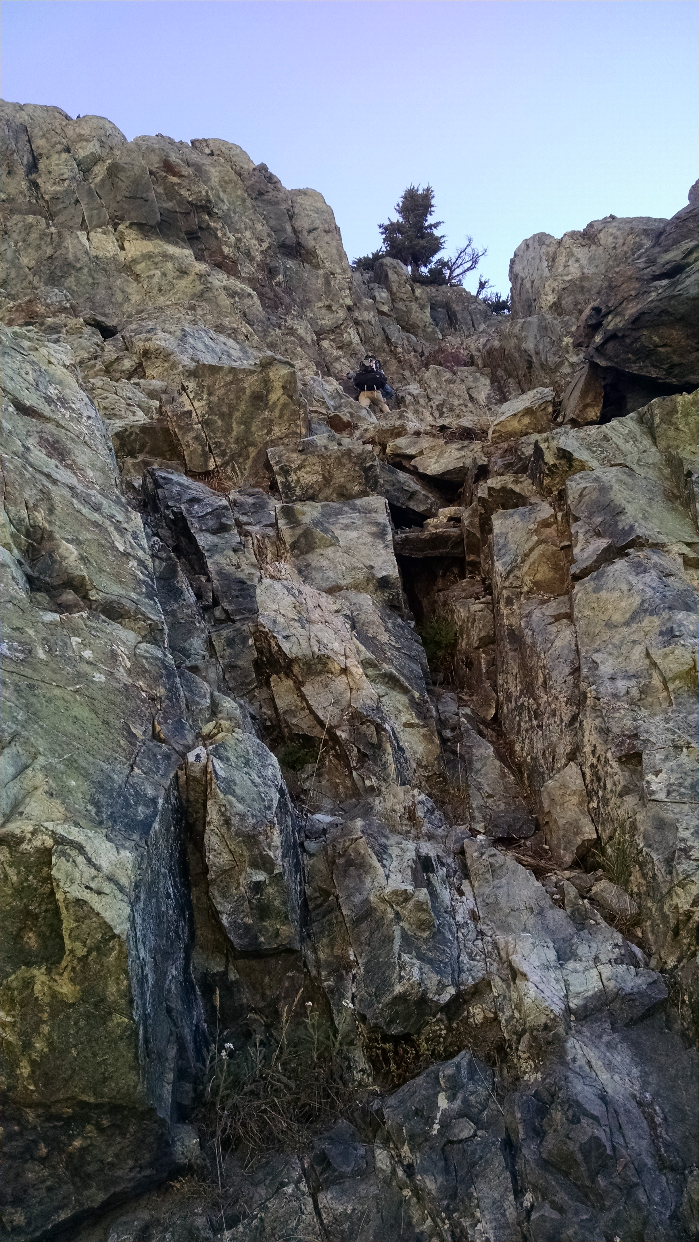
We pose for obligatory photos at the Milford Track sign, and establish early our position at back of the line. It is a brisk flat hike through a tunnel of beech trees to the Glade House. We receive refreshments and our room assignments.  We drop off our gear and regroup for a warm up nature hike to learn the local flora and fauna.
Much of the talk is drowned out by the resupply helicopter bringing multiple trips of human food in, and human waste out. We hope these two don’t get mixed up. Terri experiences her first biting sandflies, and is unsuccessful at biting them back. 

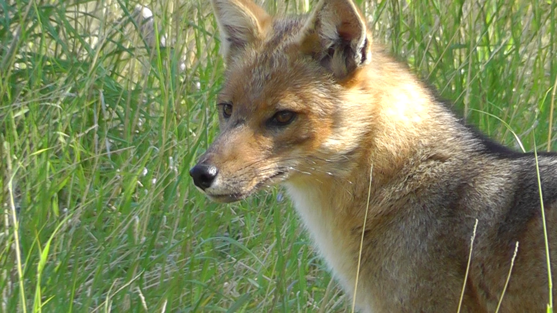
We learn about the local Lance Tree, which has a strange and spiny juvenile form until it reaches about 8 feet high. This is believed to have warded off the now extinct 9 foot tall Moa bird. Appatently it worked. Our guide Jon tricks us into participating in a variety of ridiculous plant experiments. The pepper leaf offers a strange burning sensation when chewed. The spice curve is exponential, starting out quite mild, and ending with desperate spitting. We are handed another unidentified leaf, which we roll in our fingers until it gradually releases its secret and understated name: stink wood. We decide to pass on the berries, which accidentally killed three circus elephants that grazed upon them – not right in front of us, mind you, but disturbing none the less.

After regaining our confidence in food, we are served a wonderful dinner of venison and salmon, followed by apple strudel and ice cream. After dessert, we have an after dessert dessert of coffee and small brownies. Unless we swim home at the end, we will not be losing weight on this trip.

Lights go out at 10, when the generator is switched off. At least that is what we are told. We are sound asleep long before that happens.

MT Day 0 – Milford Track

Milford Track

Milford Track

Situated in Fiordland National Park, Southland, New Zealand is the 53.5 km Milford Track- the “finest walk in the world.” That bold claim can be found on most New Zealand tourism websites.

  • Advertised around the globe as ‘The Finest Walk in the World’… – TripAdvisor.com
  • Experience ‘the finest walk in the world’  – www.doc.govt.nz/milfordtrack
  • anyone with a reasonable level of fitness can do the “finest walk in the world” – ActiveAdventures.com

And if that is not proof enough, you can purchase online:

  • Finest Hike in the World: New Zealand’s Milford Track VHS – Amazon.com

If someone can actually sell a VHS of this trek, it has got to be good!

This “finest” claim originates from Blanche Edith Baughan, a British journalist and poet, who apparently in 1908 wrote an article in the London Spector titled “The Finest Walk in the World.”  It was re-published in book form in 1909.  I have not been able to find one, although The National Library of New Zealand claims to have a 66 page 4th edition, published in 1926. If you happen to find and read it, you can be the first ever to review it on GoogleBooks.

Google Review Anyone?

The evening before the trip we attend a required orientation meeting, where we gather up our backpacks, liners, and luggage tags. In reality we are gathering up our courage as we check out our fellow hikers. “He looks out of shape, surely I can keep up with him. She looks about seventy but wow, look at her leg muscles. I better introduce myself now because I am never gonna see her on the trail.”

We return to pack what for me is the lightest backpack I have ever carried on a trek – no sleeping bag, no tent, no stove, and no food.  Maybe this really is going to be the finest hike in the world.

“O Circuit” Day 9 – Las Torres

It is true that even a stopped clock is right twice a day, assuming of course it is not a sun dial, which ours is far from being. It rained all night, and continues to rain this morning. Our breakfast will be served at eight, and check-out is at nine. Packing up, keeping dry, getting food, and finding a place to ditch our packs, is our morning’s mission. Any chance of seeing the Torres Del Paine is pretty much shot. But like Atticus Finch or Don Quixote, we will try.

We realize storage for backpacks is at a premium. There is one small outdoor alcove, mostly protected, and we cram our packs into it. Others follow suit, so ours are now completely covered, but will be difficult to retrieve.

Breakfast in Chileno is chaos. Those with rooms have the early 7:00am seating, campers like us are seated at 8:00am. That is of course if you are willing to sit on a 7:00 am-ers lap, as they continue to eat well beyond 8:30. We are finally seated, but must wait what seems like forever for coffee and eggs. The coffee is so dreadful we wonder why we waited at all. I fill up with bread and caramelized jelly, plus corn flakes and warm milk, from what animal I am not quite sure. We Americans really are pigs, expecting far more service than the Chilean resources seem capable to provide.

Torres Base

Torres Base

We eventually grab our sack lunch, pack up, and head out into the rain. The primary reason for our sojourn is to pay respects at the foot of the parks namesake, Torres Del Paine. Our faith is based on believing, rather than seeing. Over time our water proof gear begins to water. We are soaking from wet-head to sloshy-sock. We splash through mud and dance over rickety bridges, clearly unworthy of OSHA approval. The final 45 minutes are steep, rocky, wet, and futile. We appear at the shore of the small largo below the towers, the towers, however, fail to appear.

We dash, fall and slide back down to Chileno. We squeeze in soaked to soak in the warmth of the huddled steamy tourists. The smell is probably as you imagine. Our clothes never dry, but protected from the wind, warm ever so slightly. The entire Chileno service crew is eating lunch, so all tourist services are on hold. In other words, we cannot order hot drinks and food, but we can watch employees consume them.

We push back into the cold, and climb out of Chileno and down the long stretch to our final camp, Las Torres. We get a break in the weather, dry our tents and quickly set them back up as the rain returns. It continues off and on, but never very long.

Tomorrow afternoon we will catch the bus back to Natales.

“O Circuit” Day 8 – Chileno

We wake on our platform peak to the gentle sounds of off and on rain. We heat water for coffee and wait for a rain-break, in order to pack up for a trail-break. A guide we met at the top of Britanico is now putting on her rain pants. “It is going to rain pretty hard all day,” she warns. I point out the similarity to yesterday’s incorrect prediction. She is adamant. Based on her professional experience, this is for real. John, Brian and I dutifully put on our rain gear. Mark, the non-believer, goes light. It begins to rain, but not very hard, and not for long. We are soon perspiring in our pessimism, except optimistic Mark, whose temperature remains optimal. We hate him for it.

The rest of the day we leapfrog the guide and her two Indian clients. Each time we pass we remind her of the current weather. She simply smiles and says, “Patagonia.”

To Chileno

To Chileno

Brian is not feeling well. He appears to be fighting a sore throat, but presses on. The views on the right cheek of the W (as Brian refers to it) are not the most spectacular of the trip, but they will do. We take the shortcut trail towards Chileno, then turn a corner and up the home stretch. It rains slightly off and on, but nothing to write about. Okay I lied, but you shouldn’t read much into it.

Chileno Tent Platform

Chileno Tent Platform

At Chileno we are assigned platforms on which to construct our tents. The screw heads on the platform stick up so far we fear our tent footprint will be destroyed. A worker lays down a strip of masking tape, as if it possesses magic anti-ripping powers.

No cooking is allowed by backpackers at Chileno, so we are required to take full board. Dinner is not until 8, so we beg the kitchen for some boiling water and rehydrate our refried beans for burritos.

Brian’s company phone, which is a replacement for one that accidentally went through the wash, is acting up. It got damp early in the trip, and he has had it off ever since. Currently it will not come on, so we have it on external lithium battery life support, with hope if not for a full recovery, at least one to a reasonable quality of life.

Tomorrow we will climb and attempt to see the Torres Del Paine. The weather forecast is 100% rain all day. We think this is good news, given that predictions have been so consistently wrong.

“O Circuit” Day 7 – Frances

Leaving Paine Grande

Leaving Paine Grande

It rained all night, but fizzles out as we wake at 6:30 am. The kitchen area does not open until 7:00 am, so Brian heats water for coffee at a nearby picnic table. A French girl warns us she has been severely scolded for cooking there. A few years ago that is precisely where I was told to cook. These rules are so hard to follow.

Mark picks up a weather forecast: 93% chance of light rain all day. It begins to sprinkle, so we quickly pack up our damp tents before they become completely soaked tents. We put on rain pants and jackets, and get an early jump. Within an hour of hiking, in the now blaring sun, we are near heat stroke. Brian proclaims, “Patagonia sure is hot, except when it’s really cold.” Patagonia weather is very strange.

We make our way to the recently, but now formerly, collapsed bridge. There is new wood, cables, and hardware, yet somehow it retains that “far from perfect but probably good enough” feel. We cross with little fanfare to Camp Italiano, where we stop for a quick lunch. Brian and I mix up powdered humus and stuff it into tortillas and then into our mouths. We ditch our backpacks by the ranger station and begin our significantly less burdened climb up the French Valley. The cliff hanging glaciers put on entertaining shows by pushing their friends over the edge. The thunderous roars and rushing avalanches never get old.

French Valley

French Valley

There is a crowd at the French Mirador, but it thins significantly as we work our way towards Britanico. The advertised 3 hour climb takes us about 2, even with Brian’s non-bending knee. The views from the final lookout are spectacular. It is for me the most spectacular single spot in the entire national park.

We take a variety of pictures, which will clearly do no justice to the spectacle. We work our way back down towards our packs. The down is harder on all our knees, but especially Brian’s. We re-shoulder our burdens and head across the middle of the “W” towards the new Frances Refugio. We check in and begin the engineering adventure of pitching our tents on staggered wooden platforms, constructed on a steep forested floor. Tent stakes need not apply, though a provided hatchet and a handful of nails helps significantly.

French Valley

French Valley

It begins to rain as we cook our meals pitched on our platforms. Brian declares this a far more dangerous fire hazard than the illegal-to-cook-on picnic tables of this morning. Patagonia rules are as fickle as the weather.

Tomorrow we will glide beneath Los Cuernos, and make our way up to Chileno.

“O Circuit” Day 6 – Paine Grande

I wake during the short period of darkness known as night, for biological reasons, and enjoy the southern stars. Orion is out and familiar, but the Southern Cross is not often in my view. The next time I wake we are re-treated with the huge fox, apparently quite comfortable in camp. Brian, John and I head to the lodge for our breakfast board. We explain that our fourth, Mark, will be along shortly, but that we would enjoy starting with just coffee while we wait. Heads nod in total agreement, and then immediately our toast and eggs arrive. Rather than let our only chance at hot food get cold, we shrug and try to enjoy the Mark-less meal. Mark eventually arrives for his toast and eggs. By now, we are well into multiple bowls of cereal and yogurt. At least in terms of feeling full, Brian declares this one of our better meals. John asks for more bread, which is resoundedly refused, with obvious disgust for the North American pigs that we are. We are provided sack lunches of sandwiches, nuts and bars for our journey on.

Lunch stop near Grey Glacier

Lunch stop near Grey Glacier

We pack up in no particular hurry, then head south down the west side of the circuit. The views of Grey Glacier and largo are impressive, but are slightly undermined by the exceedingly entertaining appearance of ridiculously large hares. This part of the circuit is amped up in population, and with the possible exception of John, we tire of the constant holas and small talk every 100 yards.

We break at a beautiful overlook, take pictures, then begin to indulge in sandwiches. A CONF (National Forest Corporation) employee appears and begins speaking in Spanish quite enthusiastically about our sandwiches. We assume he wants to know where to get one, and we begin a pantomime show which clearly disappoints our audience of one. His much more powerful and moving one-man show, however, convinces us we are NOT allowed to eat sandwiches anywhere other than at a refugio. Why are we provided a lunch at a refugio that we are only allowed to carry to the next refugio? Perhaps we could have simply carried a coupon to the next location, which we would be lighter and far less tempting to consume along the way. At any rate the whole thing is ridiculous, but provides humor for the hungry.

Camping at Paine Grande

Camping at Paine Grande

We arrive at Paine Grande in time to finish our sandwiches, setup camp, cook dinner, shower and play cards. Without surprise, the rain returns.

“O Circuit” Day 5 – Grey (Zero)

Fresh snow above camp

Fresh snow above camp

It rains most of the night. The good news is our dry things remain dry. The bad news is our wet things remain soaking wet. We wait for a small break, then make a break for the bathroom and the cooking room, which thankfully are two different rooms. We make several coffees, oatmeal, and Pop Tarts. The room heats up again with bodies and stoves. We hear rumor that the bridge is now open, but only to one person at a time. The military’s lack of complete confidence in their repair is a bit disconcerting, but if it holds up, will save us a tremendous amount of hassle.

Red Fox

Red Fox

Without hiking today, it is difficult not to eat more than our share. While in the cooking area the biggest fox I have ever seen strolls by. I race out in the cold to get my video camera, and to tell John to come quick with his still camera. A paparazzi of cameras begins to pursue, including two girls who have taken point. With discipline to stand our ground we can have as many wonderful pictures as we want. But alas, each of us stepping forward for a slightly better shot, keeps our friendly fox on the fly. If Aesop were alive, he would immortalize our greedy tale.

Brian and John drying

Brian and John drying

The sun peeks out between short bouts of rain. We move our wet cloths in and out of our tent, trying to keep pace. Our cloths become two steps drier, then one step wetter, during each cycle. Eventually they become dry enough that the risk of leaving them out is no longer worth it.

Tonight we have full board, which means dinner, breakfast tomorrow, and a sack lunch handed out at breakfast. We sort our food, figuring out how much we can eat. Brian and I make bean burritos for lunch.

Dinner is soup, stewed chicken, mashed potatoes, and something that seems tiramisu-like. Brian is not overly impressed, but we did not have to cook it and, more importantly, we did not have to carry it.

“O Circuit” Day 4 – Grey

Climbing towards Paso John Gardner

Climbing towards Paso John Gardner

We wake early, hoping to hike 6 hours over the pass to the free campsite at Paso. With no reservations, however, we may have to press on to Grey, an additional 5 hours according to the map. Unable to find room at the tables, we huddle around the counter where a few years ago I melted my jacket when my stove flipped over. While we heat water for coffee and oatmeal, a woman at the table knocks over her stove with a huge pot of hot milk, sending it everywhere, including the laps of strangers sitting across from her. Suddenly the counter seems nicer than the table.

We pack up and begin our long climb up the pass. The forest is a tangled web of roots and mud. We break through the trees into the exposed rocks. The light rain comes and goes, but eventually turns into light snow. The views are still spectacular. Brian’s knee is slowing him down, but not Mark, as he plows up the pass ahead of us. We are blessed with little wind and decent visibility. We meet Mark at the top, and celebrate by posing in front of the now visible Patagonia Ice Field.  We are clearly National Geographic Explorers, at least it seems to us.

Looking down on Grey Glacier

Looking down on Grey Glacier

The hike down is steep and grueling, even more so for Brian with his knee. The light snow turns back to light rain. We begin to soak through. It is deceptively slow, so Brian and I fail to switch to full rain gear. At Paso we are turned away, even with Brian’s limp and knee brace. As the rain grows in intensity, we press on. The down is not quite as steep as below the pass, but steeper than Brian wants. We negotiate a stream crossing and ladder with no problem. Knowing that a bridge has already failed in the park makes crossing the long wooden planked suspension bridge over the gorge even more exciting. Although we each cross alone, it feels as though someone is messing with us, as the bridge bounces up and down.

We soldier on in cold rain, but thank the Patagonia wind gods for their gentle kindness.

We arrive at camp soaked, drop packs and go straight to the cooking area. The propane stoves and body heat have created a soothing sauna, which we slowly absorb. Unable to stop to eat much on the way in, we gorge on calories. I shovel in spoonfuls of Nutella, while Brian makes hot water for miso soup. We pound down crackers, cheese, cookies and anything else we can dig up. Rather than set up tents, we stay until we cook dinner. Once the tents are set, we are pretty sure we will not return, and we are right.

Tomorrow we will sleep in, and attempt to dry out – assuming the sun god is willing.

“O Circuit” Day 3 – Los Perros

It rains during the night, but stops as we wake. The sun breaks through and blasts our rain fly, allowing us to pack up dry. I make coffee, oatmeal, and enjoy another smashed Honey Bun. Brian takes a quick shower and we are on the trail by 9:15 am.

Looking back to Dickson Glacier

Looking back to Dickson Glacier

The hike out of Dickson is up, but pays us back with great views of Dickson largo and glacier. The trees becomes lush and rainforest like. Brian asks why I did not tell him about the awesome trees. Not completely distracted by the trees, Brian’s knee begins to bother him. At a creekside stop he takes Ibuprofen and borrows a knee support from Mark. The going is slowed, but no one seems to mind as we soak in the views and enjoy the songs of the song birds. The sun appears and disappears frequently enough to keep us guessing as to what to wear. We stop at a waterfall cascade for a lunch of salami, cheese and crackers.

Los Perros Glacier

Los Perros Glacier

After a steep scramble up loose rocks we crest to spectacular views of Los Perros Glacier. It is windy and cold, but we hang around long enough to be rewarded with an entertaining snow avalanche, which spills over a cliff like a Yosemite waterfall.

At Los Perros we check in, then set up tents in a brief hail storm. The weather is fickle and constantly changing. We join a group in the cooking shelter. We are the only USA representatives, but feel quite welcome, and squeeze in to make our meals. I cook Thai curry rice with Thai tuna. Brian makes a concoction of fettuccine noodles, soup mix and tuna, which he declares a success, even though he burns it on the bottom of his pan.

Later Brian and I play pitch, while Mark looks on, between bites of mashed potatoes and spam.

We plan to go over the pass and stay at Paso, but Mark never figured out how to make a reservation. We are hoping they will not turn away a limping Brian in a knee brace. The Ranger said the weather tomorrow should be like today, which means sun, clouds, rain, hail, and wind.

Welcome to Patagonia.

“O Circuit” Day 2 – Dickson

Yesterday’s late down translates into today’s late up. The sun beats us up by several hours. Although honey was confiscated, Honey Buns were not. I make a breakfast of a big fat Honey Bun, oatmeal, and Starbucks Via coffee.

We hike our way up and around the famously windy pass above Lago Paine. Brian is knocked to the ground at least once. We are all walking like drunken sailors against the amazing force. John tries to blow snot out his nose, which goes airborne in an unexpected direction. Turning to avoid his own projectile, the momentum of his pack spins him around and he falls completely off the trail.

The ranger at Coiron takes our passport information, then provides us news that the Chilean military has been called in to repair the bridge. They now expect it will be done in 5 days. Given we were told in Seron it would be fixed in 2 days, we are not sure their presence is helping.

Looking Down on Dickson

Looking Down on Dickson

We make it to the Dickson overlook, where Brian asks if there are possibly better views than this, or if this is this as good as it gets. We set up camp well ahead our our previous night’s record of 10 pm. To kill some time, we hike along the shore in search of better views of Dickson glacier. I have mashed potato with hickory tuna burritos for dinner.

The ranger tells us rain is likely tomorrow during our hike to Los Perros. We do not like this ranger.

“O Circuit” Day 1 – Seron

Flying Through Natales

Flying Through Natales

Brian and I wake 15 minutes late for breakfast. So much for redemption. Mark and John are already enjoying the crepes and coffee crystals. We join in for ham, cheese and rolls. After eating, we sort and pack our gear and food. The food seams far less than we want to eat, yet far more than want to carry. We have full board twice on the trip, so we only we need 7 days of food.

Mylodon Hug

Mylodon Hug

We leave our bags at the hostel and play tourist for the morning. We could have taken the 7:30 am bus to the park, but given our oversleep performance, we would have certainly missed it. Besides, walking before we go walking seems like such a good idea. The next bus is not until 2:30 pm, so we have plenty of time. We get massive sandwiches, which we use to lead a parade of dogs throughout town.

From the bus to the park, we see plenty of guanacos, rheas, and eventually the massif Torres Del Paine. At the gate we pay, get maps, and view a mandatory video, whose main point is that if we start an accidental fire we will spend six bonus years in Chile, probably making license plates. At the end of the video, there is a Spanish announcement which causes quite a ruckus, involving frantic disappointed glances and hand gestures. Eventually an English version is released. A critical bridge is out and to complete the W route or the full O circuit requires a catamaran excursion and significant doubling back. Trekkers have come from around the world, only to find the alphabet broken. There is some hope that O circuit folks like us may find the bridge repaired by the time we arrive, almost a week later.

Adding to our confusion, the trail from the guard shack, which we plan to take to Seron, does not appear on the current map. We are told it is decommissioned and we must go to Las Torres, via another bus for 3,000 play money per person.

Brian is laughing as we finally hit the trail. He has never started a backpacking trek at 6:00 pm. Luckily we are so far south that it stays light until 10:00 pm. We make our way and beat the barely setting sun. By the time we set up camp and have dinner, it is 11:00 pm. An Australian overhears Brian’s concern about having enough food and offers to share some. We assure him we are not hungry enough for Vegemite, but he seems more than pleased and quite surprised when I offer him a precious Cherry Ripe. He shares good news that the bridge is expected to be repaired in two days.

As we try to sleep, the locals scream-talk at each other over blasting music, for several more hours.

“O Circuit” Day 0 – Getting There

Goofing on the Plane

The night before my flight to Miami I realize my American Airline boarding pass says “Rick”, from my old Advantage Milage profile. All my identification of course says “Richard”. I call customer service and a very nice woman tells me she is happy to fix it, but I risk losing my assigned seat. She suggests I go to the airport ticket counter early, where they can easily do it and keep the seat.

The next day at the counter, Gary, counters her claim, telling me a name change will cost $200. I explain that I called customer service and the agent said it can be done free of charge. He tells me it can, if there are notes in the electronic record, but there are no notes. He speaks to a supervisor and returns with the same undesirable answer. My explanation in person, with full emotion and hand gestures, is apparently not worth $200.

I keep the wrong named ticket and try my luck at security, where I have plenty of time to make new friends, including the security supervisor who desperately wants me to have something with the name Rick on it. I show her my connecting boarding passes on LATAM airline with Richard, but this creates another suspicious situation. Why do I have so many boarding passes? I explain that the LATAM website says I need 2 copies for each leg of the flight, 1 for the airline and 1 for me to carry onto the plane. Making it worse, I have Brian’s 4 boarding passes printed to give him in Miami. I stand before the mercy of security, with an endless stack of boarding passes for Rick Romine, Richard Romine, and Brian Romine. Apparently multiple personality disorder is a TSA protected class, as I am eventually given leave to go.

In Miami we are to meet John, but there is more confusion. Brian and my bags are only booked to Miami, so we have to exit security, pick them up, then go back through security.  I arrive at Concourse D, then walk further than the Patagonia “O Circuit” to get to Concourse H, where I meet Brian. John texts a picture of himself, and we wait for him in front of the LATAM ticket counter. The line keeps getting longer, and John never arrives. Later we will learn he missed us, reprinted his boarding pass and went back through security ahead of us. Giving up on John, we join the huddled masses in ticket line. The line is so slow they stop taking people from the front, and start pulling people from the back who are about to miss their flight. The longer this goes on, the more people who were on time are now also about to miss their flights. I feel as though we are in socialist Venezuela, where everyone will equally miss their flight.

In Santiago we go through Immigration and then Customs. What food you are allowed to take into Chile is a complete crapshoot, but not declaring food can bring significant fines. We all declare plant based food, but get very different examinations. John receives the full treatment, meaning they go through everything. The customs agent is particularly excited to confiscate his honey packets. His dual packets of salami and cheese get mixed reviews. They cut off all the salami sicks but give back his cheese, which is strange since dairy products are listed as forbidden. Another agent starts looking through my food bags, and becomes so overwhelmed by the quantity, she simply lets me go. Yet another agent waves Brian through without so much as a single question. They have clearly had enough of us – next please!

In Punta Arenas, we have reservations for the 3:00 pm bus to Puerto Natales. We try to get on an earlier bus but get busted instead. I tire of the freezing cold wind, and go inside to try my luck at the ATM slot machine. I receive translation support from a German who reads Spanish and speaks English. I lose service charges to the house, but eventually win a pile of extremely fake looking money. Finally on a bus, we see ostrich-like rheas running in the road. The bus driver honks his horn, well actually the buses’, but the rheas seem not to care. Brian is amazed at the amount of counter correction required to drive a bus in the Chilean wind.

We arrive in Puerto Natales and walk towards the hostel. We are clearly important dignitaries, as a team of the city’s finest K9s escort us from street corner to street corner. Each dog has its own territory, and the handoffs at each crossing are cordial, yet formal. We check into the hostel, throw down our things, then head quickly to the market for salami replacements and various minor items.

We walk to Erratic Rock for fuel canisters, since we were not allowed to bring them on the plane. We luck out and find a free partial in the hiker bin and purchase three others, some of which will probably go back into a hiker bin at the end of our trip.

Back at the hostel, Brian is crashing and ends up sprawled across his open roller bag, zipper marks embedded in his sleeping face. We buy late bus tickets for tomorrow, since we clearly are not packing tonight. We will still have time to hike, because it stays light until 10pm.

John, Mark and I leave Sleeping Beauty, and go ask the hostel hostess for a restaurant recommendation. She suggests El Bote. I ask for her favorite dish, which she describes in broken Spanglish as some kind of meat that sounds to me like casserole. The hunt is on.

Guanaco Cacerola

Guanaco Cacerola

On top of the restaurant menu board at El Bote is Guanaco Cacerola, described in English as Patagonian camel stew. This has to be what she meant, so I order it. It is quite tasty, very much like beef stew in a wine sauce. I return to the hostel, thank her for the recommendation and proudly tell her I ate the Guanaco. Her face drops as if I have just eaten her family’s puppy. I gather Guanaco is not what she was telling me to order.

I fall asleep full of guilt and guanaco, hoping to do better in the morning.

SHR Day 20 – Horse Creek (33)

Spiller Creek to Twin Lakes

Looking back to Horsecreek Pass

Looking back to Horse Creek Pass

The wind picked up and howled throughout the night. It continues now this morning. Our broken-zipper doors face directly into the wind, so our tents, and even sleeping bags, blow up like crazy clown balloons. Although very cold, it is a dry wind, for which we are very thankful. The moon, nearly full, was so bright last night it kept us up. No bother. We are up now, and today is moving day.

We pack, have our last wilderness breakfast, and begin to stroll up the gentle slope of Spiller Creek. It is deceptively simple, for beyond Horse Creek Pass, the 33rd and final pass, is a long nasty run of talus and scree. Kevin points out that it would not be the Sierra High Route without it. There are occasional social trails, which appear and disappear without explanation. I am ready for this to be over, but it is not.

Twin Lakes Marina

Twin Lakes Marina

We begin thinking about Terri, my uber wife, Kevin’s uber mother, and at this important moment, our uber driver.  Will she be waiting for us, or will we be waiting for her?  Her track record from the PCT is good, but Kevin is not giving good odds on the over/under.

As we drop down Horse Creek, the talus begins to thin, and the trail begins to thicken. There are now trees and switchbacks. We begin to see more and more hikers.  A few people ask, “Where are you coming from?” It is too long a story. Besides, right now all we care about is: where we are going… to Twin Lakes, to cold drinks, to showers, to laundry, to pizza, and home.

This all started 20 days ago, in Kings Canyon, at a place called Road’s End. And now, as we reach the other End of the Road, we celebrate… and wait for our driver. About 20 minutes it turns out. We are sure glad to see her.

End of the Road Celebration

End of the Road Celebration

SHR Day 19 – Sky Pilot Col (31), Stanton (32)

Cascade Lake to Spiller Creek

We wake as we knew we would, cold and wet. The melted snow is now frozen water, on the ground, on our tents, and condensed inside our tent. Our water bottles are frozen. The stars are still out, which is a good sign our closest one will also appear and begin drying us out.

We stay hidden in our frozen tent caves until actual sun rays reach us. We slowly move things around, brush them off, and position them appropriately for the sun god. It is 9:30am by the time we get going, and we have to stop for non-frozen water to filter, so it is closer to 10:00am when we start our assent of Sky Pilot Col.

Sky Pilot Col

Sky Pilot Col

Sky Pilot Col feels like a triple by-pass. First we scramble up to a tarn. Second we scramble up nasty talus blocks, which keeps getting steeper. It is like the sloped wall in American Ninja Warriors. Third we scramble up loose scree, which keeps getting even steeper and looser. The ground is so unstable, each step forward involves some sliding backwards. There are times we slide further backwards than we stepped forward.

Looking forward from Sky Pilot Col

Looking forward from Sky Pilot Col

The view at the top is amazing, but even more amazing – my phone starts dinging with messages from Terri. I didn’t even know I was not in airplane mode. I try to call, but that fails. The few text messages that went through made it seem we were on track to be picked up tomorrow. It sounds great, though frankly, we have lots of miles and elevation left to do to make that happen.

The trip down from Sky Pilot Col was crazier than the up. The down can only be described as a series of bone chilling avalanches. Each step was a complete mystery. It could be a normal step on reasonably stable scree, or it could be the beginning of a Mister Toad’s wild ride, as a large section of rock appears to liquify and make a run for it.

Looking back at Sky Pilot Col

Looking back at Sky Pilot Col

The steepness eventually becomes more reasonable, and the avalanches less frequent. Instead we faced miles and miles of miserable boulder and rock hopping. It seems like we are killing ourselves, and yet have so little mileage to show for it.

We eventually reach Shepard Lake, where we take a break and snack. We continue down towards Virginia Canyon. The journey is through mazes of willows, and eventually a not so pleasant crashing through the forest. Each step down is made more painful because, as soon as we reach the bottom, we will cross the creek and climb right back up over 1,400 feet of elevation.

The climb up out of Virginia Canyon for me is miserable. The forest is steep and thick. We are constantly zig zagging, trying to get over logs, around brush, and over rocks. You really can’t see the forest for the trees, and the maze offers no feeling of progress. I need to stop for physical and mental breaks. I can tell Kevin is worried we will not be making the necessary miles to get out tomorrow.

Soldier Lake

Soldier Lake

We eventually break out into open granite and I get a second wind. We press up to Soldier Lake, where we fill a water bottle and move on up past Grey Butte. We are now staring across at Stanton Pass. It looks ridiculously steep, with impassible cliffs, but given that this is our 32 pass, and we felt the same way about most of them, we just shrug our shoulders and press on. We dip down to a tarn, where Kevin fills a bottle, and we start up. Our GPS waypoints indicate we should move right, but Kevin likes the look of a ramp/ledge on the left. We traverse to it, and eventually slide into place a little above the pass, but perfectly.

Stanton Pass to Spiller Creek

Stanton Pass to Spiller Creek

From Stanton Pass, we can now see Spiller Creek, our goal for the night. Like most passes, the down side seems way worse than the up. There are several “you have got to be kidding” moments. At one point, Kevin falls, flinging one of his trekking poles on an amazing flight. The slope eventually un-slopes a bit, and we struggle the rest of the way down, with Kevin reminding me it is past his mountain bedtime.

We crash through brush and willows, and find a flat spot in the valley. We setup camp, cook, and retire to bed, knowing we have only one more pass, and we should be done by tomorrow.

SHR Day 18 – Mine Shaft (29), Spuller-Maul (30)

Tuolumne Meadows to Cascade Lake

We again wake in total darkness. Getting any early jump in September is difficult. I pack up and visit the flush toilet one last time. After consuming muffins we purchased yesterday at the store, we now need to get back to the trail. Roper warns of a potential river ford, which given the drought is probably not a problem, but we road walk just in case. The lack of any walking space next to the road, makes it more exciting than the wilderness.

We reach the Gaylor Lakes trailhead and head up. Across a meadow we see a huge black bear. This time there is no confusion with a dog. If the bear stood up, he would look exactly like you’d expect a Sasquatch to look.

Great Sierra Mine

Great Sierra Mine

We next work our way up a steep slope to the ruins of the Great Sierra Mine. Rock structures, in somewhat disarray, are scattered about. The walls are extremely thick, which according to Roper means they worked the mine in the winter as well. We go over Mine Shaft pass.

Dark clouds are forming around us. The 40% odds are starting to seem low.

To avoid dropping all the way down to Fantail Lake, we make a massive traverse left, across unstable talus. We then drop down a wacky chute to Spuller Lake. It begins to snow off and on, and the storm is clearly catching up to us from behind. We consider pitching tents and hunkering down, but it is only noon. We agree to push on to Maul Lake and consider our options before facing the Spuller-Maul Pass.

After a snack, we figure we have nothing to lose, other than our lives, so up we go. The snow gets serious, pelting bean bag stuffing, sleet, and fluffy flakes. It is as if Mother Nature is trying to get our attention, but we are not listening.

Spiller/Maul Lake Pass

Spiller/Maul Lake Pass

At the top of the pass, it is clear going down the other side without a flying squirrel suit is not possible. We travel up and to the left, until we find a class 2 chute of talus we can negotiate down. The sky is darkening and the snow intense-ing. We pass by Conness Lakes, and scramble over a small saddle towards Cascade Lake. It is so stormy now, we cannot even see the lake, nor anywhere to camp. We duck into a small rock cave, to wait out the worst, and consider our options. No longer moving, we are now cold, so we snack, change into rain gear and add layers.

At a brief break we pitch our tents, but it starts snowing again. There is an inch of snow now on our tents. Once set, we return to our dry rock cave and cook Indian Curries with rice. The snow stops again, and we slip into our tents. We are well satisfied with today’s milage, but realize breaking camp tomorrow may take longer than usual.

SHR Day 17 – Vogelsang (27), Tuolumne (28)

Lyle Fork to Tuolumne Meadows

I wake in total darkness and begin packing up. I am hoping to get an early jump on what seems like a long day. Kevin, however, seems less concerned. My packing does not seem to disturb him in the least. He eventually comes around, and we are on the trail by 6:30am.

We begin a long upward traverse along spectacular cliffs overlooking Lyell Creek. We are salmon headed up against a sea of Conservation Corp trail workers, coming down to work the Isberg Pass Trail. We eventually come upon their massive encampment, with comically large everything: huge tarp buildings, pots I could climb into and bathe, giant hanging ladles. It reminds me of Buster Keaton cooking in the galley of an huge abandoned ship. Well, I doubt it would remind anyone else, but it does me.

Vogelsang Pass

Vogelsang Pass

We then drop down the zig zaggy switchbacks to Lewis Creek. We snack, with me dreading the long up towards Vogelsang Pass. It takes several more snacks, electrolytes, and Kevin’s patience to get me to the top. After a brief rest, we meander down and over the gentle Tuolumne Pass.

From Tuolumne Pass, the rest of the day is a long, long down by Rafferty Creek. The creek, however, is missing one key ingredient: water. The down is easier on me than the up, but the trail has a nasty design. Every 10 or so feet, there is a massive granite block/drop. I am sure it is designed to prevent erosion, but it is momentous and painfully jarring on my internal organs, which it turns out is most of them.

We drop down into Tuolumne Meadow, and join the PCT/JMT for a march to the campground, and more importantly, the Post Office, store, and hamburger joint. The hamburgers are mediocre at best, but our standards are pretty low. Both our packages are at the PO, so we will have food for the next leg, and a SPOT so Terri will know when and where to get us.

We are now trying to sleep in the $6/person backpackers campground. A ranger is doing his best to host a rousing campfire program about trees, which to us, is way more noise than we actually want. He just told the crowd there is a 40% chance of thunderstorms the next few days. I really do not like this chipper ranger.

Tomorrow we start the final leg of our trip, thunderstorms or not.

SHR Day 16 – Blue Lake (26)

Twin Island Lakes to Lyle Fork

We wake with tents and sleeping bags wet with condensation, making for a slower than usual start. We climb up and around the higher Twin Island Lake, to the outlet. We head southwest around a steep ridge, then head northwest, trying to gain elevation towards an unnamed lake. The steepness of the side slope and required gain is more than I expected. I can feel myself struggling. Today just might not be my day.

Bench towards Blue Lakes Pass

Bench towards Blue Lake Pass

After a snack and break at the lake, we have another massive side slope, where we target a notch on the ridge. It is a mindless talus and scree traverse. The views down into Bench Canyon are spectacular, with one problem; we have to figure out how to get down there. The GPS waypoints make it look like a straight shot, but it isn’t.  We zig zag down loose talus to the bench. Down like this is not the long gentle down you feel like you earned after a grueling up. This was a grueling down.

The bench is relatively flat, so we enjoy a reasonable stroll through beautiful country. The creek is fairly dry, and big trout are trapped in short runs and shallow pools. Kevin again is sure we should give them purpose by eating them.

Blue Lakes from Blue Lakes Pass

Blue Lake from Blue Lake Pass

We then hump it up a much steeper incline to Blue Lake. Black clouds are again forming in the classic Sierra thunderstorm manner. I would love to rest at the lake longer, but we push forward to avoid being caught in lightning, on the treeless pass, holding metal trekking poles. Roper describes this pass as “remarkably easy,” which we seriously doubt staring at it. The boulder hopping and granite slabs seem straight up. Within a half hour, however, we are standing at the top, remarking, if only to give Roper his due.

Talus below Blue Lakes Pass

Talus below Blue Lake Pass

As we scramble down from Blue Lake Pass, it begins to rain. Talus boulders are hard enough to hop dry, but when wet, the fun really begins. We now hear thunder, and the rain thickens, then hardens into out right hail. At the bottom is a small lake and a couple of good sized granite blocks. We set up a temporary refuge under the rocks. We keep our packs and clothes relatively dry, as we make a tortilla wrap lunch. Birds keep flying to our rock shelter entrance, then squawking when they see us. This must normally be their thunderstorm shelter. The thunder and hail are strong enough to keep us hunkered in place for about an hour. This is not helping us with my aggressive mile schedule for the day.

We repack all our gear in plastic compactor trash bags, put on rain pants and jackets, and head out in it. The sky has lightened where we are, but where we are headed it looks like all hell is breaking loose. We plow along a broad plateau, above a very steep cliff line. We push forward, knowing at some point we have to drop down. Kevin, who is well ahead of me, startles what he thinks is a large dog, but I am sure is a small bear. There is, after all, a lot of bear scat around.

We give up on finding a logical way down, and begin illogically plowing down a steep covered forest. Half walking and half falling, we make it to a valley floor. We are suppose to cross the faint Isberg Pass Trail. My GPS shows us right on it, but we never see it. We search wide in both directions, far beyond what we assume is the margin of error. We then track via GPS to the top of the chute where the trail should be, but still can’t find it. Skurka warns us not to go off the trail, which only adds insult to injury. We follow various social trails in multiple directions, but none make sense. Standing on a cliff edge, Kevin sees a clear trail far below, but how to get there is unclear. We have to go back up, and do some serious traversing to finally reach it. By the time we zig zag down the now totally easy trail, we are spent. Far shorter on miles than we had hoped, we find ourselves at a reasonable flat spot near water. It is camp.

Tomorrow we will have to do some serious trail miles to make it across to and over Vogelsang, and down to Tuolumne.

SHR Day 15 – Whitebark (23), Overlook (24), Glacier Lake (25)

Minaret Lake to Twin Island Lakes

Minaret Lake

Minaret Lake

Kevin wakes feeling much better, and we get an early jump on the day. We round the Lake’s east and north shores, then head up a light social trail towards Cecile Lake. Roper instructs us to head for a crevice on the right side of the natural damn. We aim even further right and scramble a much longer and higher class-3 chute, which actually positions us even better to round Cecile Lake. The talus blocks are tedious, but passable.

Chute to Cecile Lake

Chute to Cecile Lake

From the outlet of Cecile Lake we drop down a steep traverse of talus to the right, towards Iceberg. The social trail is completely wiped out by rock slides, but the general idea of what we need to do is clear, and we do it.

Traverse from Cecile to Iceberg Lake

Traverse from Cecile to Iceberg Lake

After rounding Iceberg Lake, we begin what is a convoluted route around the massive Mount Ritter and Banner Peak. West of Ediza Lake, we head straight for Ritter. As if juking it, at a tarn we turn 90 degrees, and traverse up and over Whitebark Pass. The north side is again steep talus, which drops us into a bowl above Garnet Lake, but requires us to climb back up an unnamed pass overlooking Thousand Island Lakes.  We push down the pass, and walk northwest along the shore of Thousand Islands, where we then pivot 90 degrees, now heading southwest up towards Glacier Lake Pass.

Garnet Lake from Whitebark Pass

Garnet Lake from Whitebark Pass

We break for a tortilla wrap of salami, cheese, and Fritos, which is amazingly good. The canyon towards Glacier Pass starts gently. We come upon thee beautiful bucks, with decent racks. As we reach higher, the grass reverts to massive talus blocks, and we aggressively boulder hop, passing a couple of women hikers along the way.

Lake Catherine

Lake Catherine

Over the pass is Lake Catherine, where I thought we might camp. The campsites are not good, and Kevin is up for pushing on to Twin Island Lakes. We rock hop around Lake Catherine to the outlet, where the world drops off significantly. To avoid cliffs, we stay right and navigate various ramps and ledges, with occasional class-3 mini chutes. We then start a long traverse towards Twin Island Lakes. Black clouds roll in, and it begins to lightly rain. I am not crazy about the steep slope on now wet stones, but it never rains too hard, and we eventually make it.

We are exhausted, but need to setup camp, filter water, and make dinner. On and off it rains as we work our chores. We have Mac & Cheese, which Kevin kicks up with garlic salt, chopped salami, sliced Jarlsberg and parmesan cheese.

As we lie in our tents, it continues to rain lightly.

SHR Day 14 – Nancy (21), Inconspicuous (22)

Mammoth Lakes to Red’s Meadow to Minaret Lake

The Mammoth Lakes Cab is to pick us up at 7:15 am. We wake in time to pack and make another dash to Schat’s Bakery across the street. We share cinnamon rolls and a lemon poppy seed muffin. I am pretty sure it is not as good as the Schat’s in Bishop, but it is way better than the one that does not exist in the wilderness.

Our cabby races us back to that Schat’s-less wilderness, in a van clearly in need of struts. We plod up the seven miles of trail before reaching Superior Lake, our exit for more cross country fun.

As we filter water at the lake, we are confused. We can see two passes, a major saddle to the left, and a minor player to the right. It appears from distant patches of packed sand/scree that both have been climbed. Roper’s description favors the left saddle, but Skurka’s maps and GPS waypoints suggest the right. Roper’s looks harder than Andrew’s, but since Roper designed the High Route, we go with his.

From Nancy Pass

From Nancy Pass

The willows and brush make scrambling up the real Nancy’s Pass one of the most frustrating yet. Controlled falling through brush on your way down from a pass is one thing, but trying to throw yourself up it is quite another. The heat, the bushes, and the steepness is taking its toll. We curse Andrew for taking the easier pass, and we curse Nancy, well just because.

Kevin is starting to feel poorly. We are not sure if it is heat exhaustion from Nancy, something he ate, or something he didn’t eat (Ben & Jerry’s milkshake). After the pass, we take more breaks and travel slower. We pass over the “Inconspicuous Saddle.”

We reach our primary goal of Minaret Lake, but decide to pass on any bonus miles. Kevin rests in the shade, while I pitch my tent and filter water for both of us. Some neighbors, large men who clearly arrived via the Minaret Lake Trail and not the cross country route over Nancy Pass, have decided to go skinny dipping. To be clear, skinny is not the right term, and this dipping is not helping Kevin feel any better.

We cook Indian curries, which you might not have picked for someone feeling poorly, but the curries are our heaviest dinner, so they are the first to go.

Kevin pitches his tent and retires early, hoping to feel better in the morning. I am hoping he does so too.

SHR Day 13 – Zero Day

Mammoth Lakes Zero

I wake and shoot across the street to Schat’s Bakery. I capture and return with a bear claw and apple fritter. It is merely a stall tactic, until we can get to a breakfast cafe for four-egg omelets and hash browns.

Ben and Jerry's closed again!

Ben and Jerry’s closed again!

Terri has agreed to purchase a SPOT replacement at the REI in Dublin, then ship it general delivery to the post office in Tuolumne Meadow. Assuming that all works out, she should be able to track our last leg of the trip, and pluck us from the wilderness on re-entry.

We sort our food, make a few additional purchases, and relax with the television satiating our intellectual hunger like Saccharin cures a sweet tooth.

After having passed 20 passes, I am beginning to understand the High Route. Completing the High Route is a lot like touring the hilly city of San Fransisco. That is, if while touring San Francisco, you avoid the cafe-lined streets, and instead climb over all the medium size buildings. You scramble up fire escapes, walk on window ledges, and hang from rain gutters to pull yourself onto the roof. Oh sure, the crowds are thin and the views are spectacular, but the views from the ground were pretty cool too.

We arrange a cab pickup for tomorrow morning, later than we want, but as early as we can get. We go back out for a light taco dinner, and to collect those evasive Ben & Jerry’s shakes. The tacos are great, but B&J closes 4 minutes before we get there. You have got to be kidding!? We hit a local shop and grab a pint of caramel ice cream, and talk about the ones that got away.